File:NYC-Band Comparison.PNG
From DavinciWiki

Size of this preview: 598 × 599 pixels.
Full resolution (2,002 × 2,006 pixels, file size: 6.78 MB, MIME type: image/png)
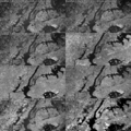
Eight satellite imagery spectral bands - LandSat 7 TM1-7 and SRTM - of Manhattan Island and the surrounding area.
File history
Click on a date/time to view the file as it appeared at that time.
| Date/Time | Thumbnail | Dimensions | User | Comment | |
|---|---|---|---|---|---|
| current | 15:19, 15 July 2012 |  | 2,002 × 2,006 (6.78 MB) | Blincoln (Talk | contribs) | Eight satellite imagery spectral bands - LandSat 7 TM1-7 and SRTM - of Manhattan Island and the surrounding area. |
- Edit this file using an external application (See the setup instructions for more information)